Tools Listing
The tools shown below represent the Description and Assessment on local level.
Jan. 20, 2025
Earth Map
Earth Map, developed by FAO and Google, is a user-friendly tool that leverages Google Earth Engine'…
Keywords: land use planning (LUP), Forest monitoring, land restoration
Sept. 13, 2024
QGIS
QGIS (Quantum Geographic Information System) is a powerful, open-source GIS software that enables u…
Keywords: SLM, land use planning (LUP), SDG 15.3.1, Forest monitoring, land restoration
May 3, 2024
KoBoToolbox
KoboToolbox is an innovative open-source platform for collecting, managing, and visualizing data. I…
Keywords: SLM, land use planning (LUP), Forest monitoring, land restoration

Nov. 8, 2023
VISUAL SOIL ASSESSM…
The maintenance of good soil quality is vital for the environmental and economic sustainability of …
Keywords: SLM
Nov. 8, 2023
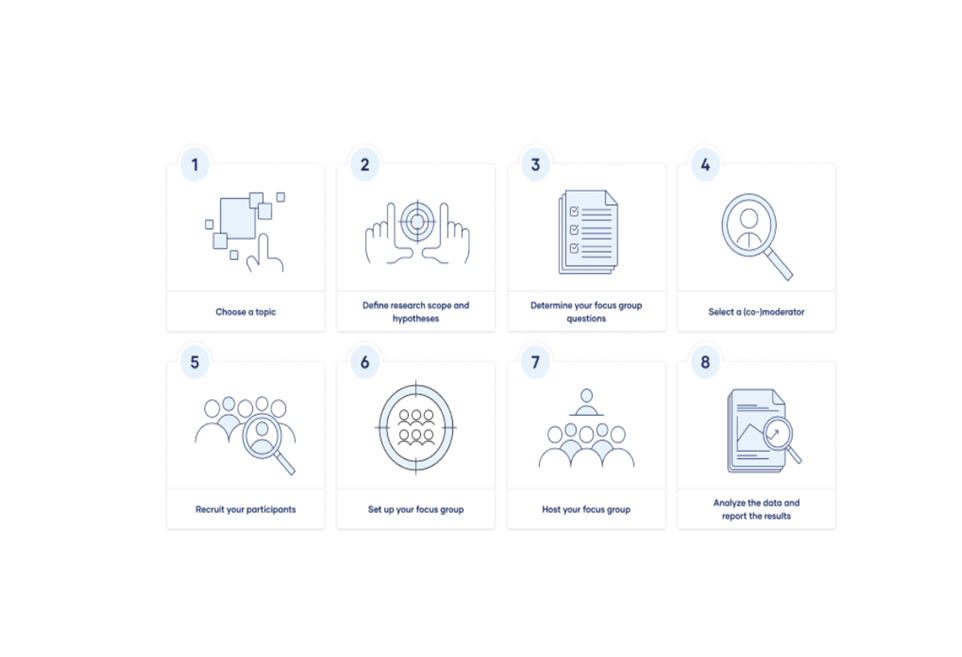
Focus Groups
Focus groups are a type of qualitative research. Observations of the group’s dynamic, their answers…
Keywords:
Nov. 6, 2023
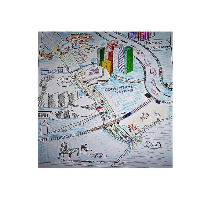
Locality mapping
• Stakeholders, either individually or in a group, draw a map of discussed geographic unit containi…
Keywords: land use planning (LUP)

Nov. 6, 2023
LADA Local Assessme…
Local data is collected through transect walks, discussions, interviews, and assessments. Stakehold…
Keywords: SLM, land use planning (LUP)
Nov. 6, 2023
MapX
The MapX philosophy facilitates stakeholder access to pertinent data for informed decision-making t…
Keywords: SLM
Nov. 3, 2023
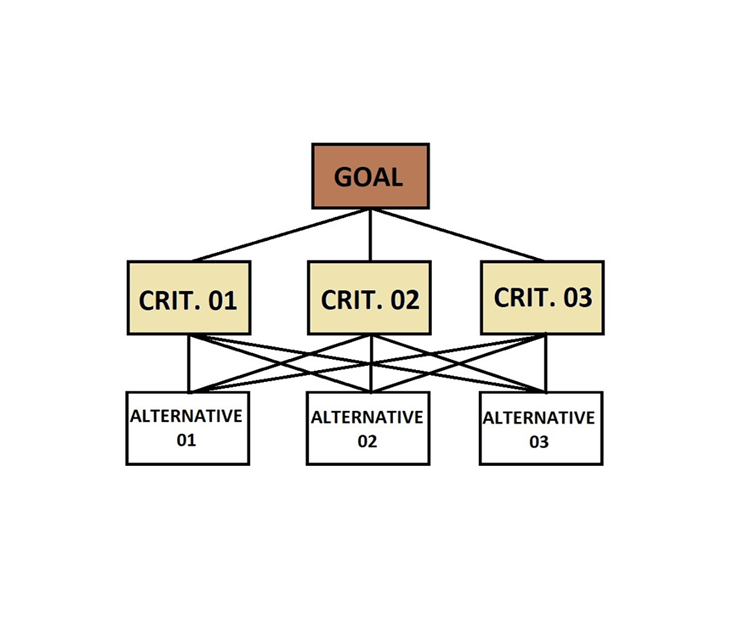
Analytical Hierarch…
The Analytical Hierarchy Process (AHP) is a widely used tool for multi-criteria analysis in natural…
Keywords: SLM, land use planning (LUP), SDG 15.3.1, Forest monitoring, land restoration
Nov. 3, 2023
LandPKS
LandPKS (Land Potential Knowledge System) is a cloud-based decision support tool that leverages cro…
Keywords: land use planning (LUP)

Nov. 3, 2023
Collect Earth
Collect Earth Online is a free, open-source system for viewing and interpreting high-resolution sat…
Keywords: Forest monitoring
Oct. 31, 2023
WOCAT-LADA-DESIRE M…
The WOCAT-LADA-DESIRE mapping tool offers guidelines and a questionnaire to integrate spatial land …
Keywords: SLM