#HowtoLDN Series
The #HowtoLDN Series features the efforts of intersectoral country teams to implement their roadmaps to Land Degradation Neutrality #LDN. These country teams are supported by #GEO-LDN Flagship since our Global Dialogue Forum 2023 in South Africa. This week we spotlight the work of #TeamGhanaCAP (Community Action Plans):
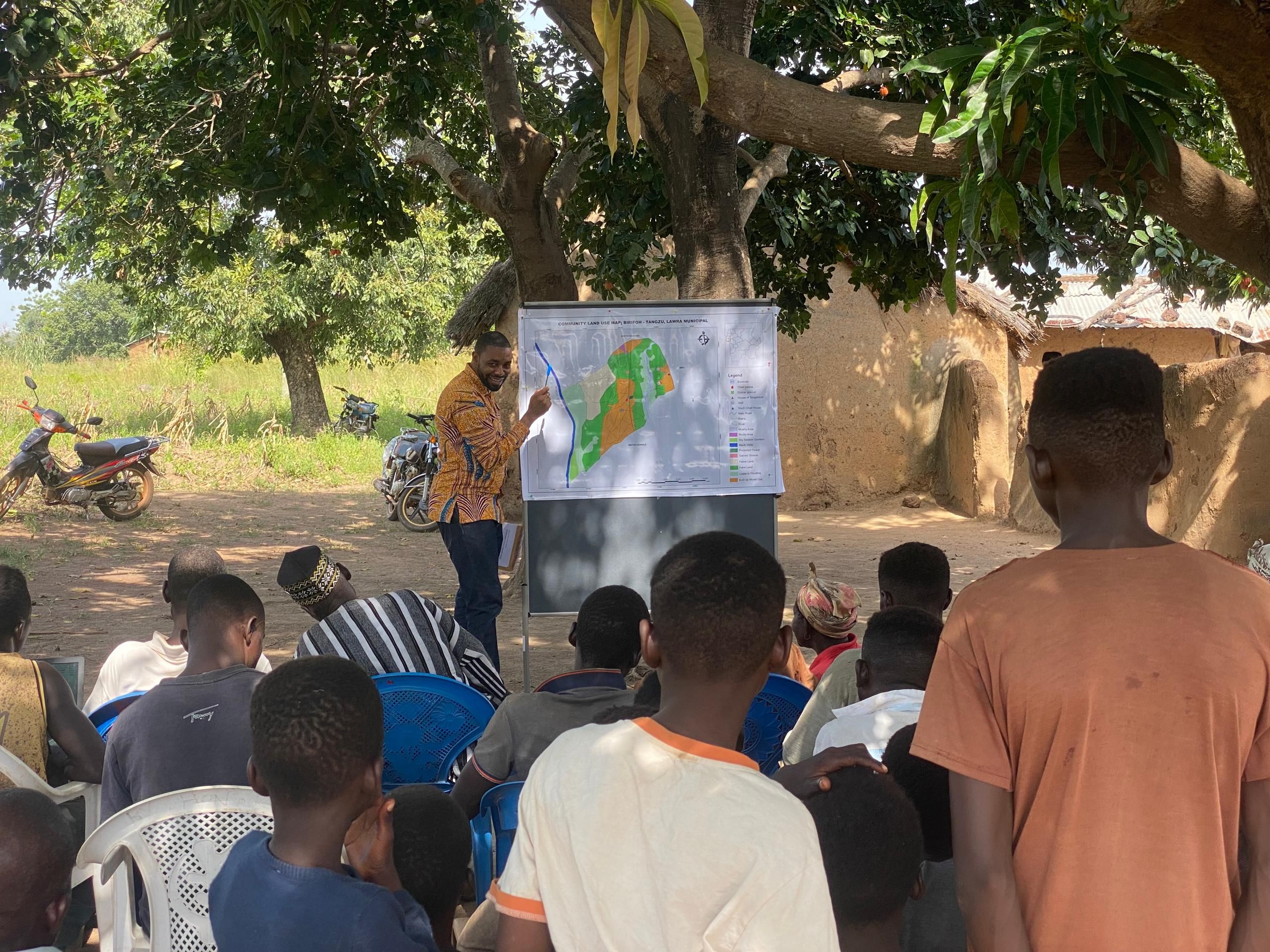
Meet the intersectoral country team in #Ghana, focusing on harnessing community actions through Integrated Planning for LDN. Community Action Planning aims to enable communities to improve planning and land management practices and enhance resource utilisation to improving livelihoods towards resilience.
Background
There remains a strong correlation between land degradation and the increasing risk and incidence of poverty and underdevelopment in Ghana, particularly within the rural landscape. The drive to effectively mobilise community actions in an integrated approach to promote land degradation neutrality and sustainable development has been limited. The Ghana CAP team is empowering communities to address their specific challenges by promoting best practices in land use and other adaptive measures in response to climate change. This approach aims to enhance adaptive capacities of communities, propel communal urgency for planning and build resilience.
The strategy leverages the community action planning guidelines developed under the Resilience Against Climate Change (EU-REACH) Project with relevant partners which involves combining non-traditional data and earth observations with traditional data gathered from community discussions and questionnaires. By engaging in participatory methods, the team can directly facilitate the mobilisation of community efforts to address the challenges faced by these communities while providing evidence to inform local governments on effective land use planning and development strategies.
The #HowToLDN use case from #TeamGhana
Working Group 4 is assisting this team by developing an LDN Decision Support System (DSS) for three different zones in Ghana, aiming to select six communities for the community action planning based on both traditional and non-traditional data.
The DSS based on Google Earth Engine (GEE) is the preliminary part of the team’s work to assess land degradation in three zones of Ghana after which community maps for the selected communities will be generated. Forms of community engagement will then be used to evaluate correlations between observed land degradation and its impacts on individuals, such as agriculture, hazards and disasters, health, and overall well-being. Ultimately, these maps will be used as a sensitization tool.
How the #GEO-LDN Flagship supported #TeamGhana
With technical support from the #GEO-LDN Flagship, EU-REACH and the PAIReD #GIZGhana projects, and a grant from the Sector Network for Rural Development (SNRD), the team is able to conduct fieldwork and facilitate the planning processes for LDN interventions in the selected communities. This enhances the capability to gather comprehensive data, analyze the extent of land degradation, and develop effective strategies for land restoration and sustainable management.
The team hopes to develop a methodology for community action planning for LDN which would become the basis for national discussions that include efforts of LDN into planning processes.