GEO-LDN at UNCCD COP16 in Riyadh
At COP16 in Riyadh, the GEO Land Degradation Neutrality Flagship (GEO-LDN) made a lasting impact by showcasing how geospatial data and Earth observation tools are key drivers in the global effort to combat land degradation and restore healthy land and ecosystems. From December 2-13, 2024, GEO-LDN brought together a diverse group of countries and experts from different organizations to engage in critical discussions and hands-on workshops aimed at advancing Land Degradation Neutrality (LDN).
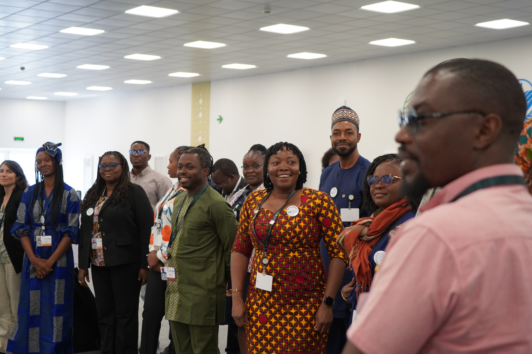
The GEO-LDN Pavilion: A Hub for Collaboration and Learning
The GEO-LDN Pavilion was a busy space throughout COP16, filled with experts, practitioners, and policymakers exchanging knowledge and sharing solutions. It was a focal point for capacity-building activities, including training sessions and interactive workshops on using geospatial tools to assess and monitor land degradation. With sessions in English, Spanish, and French, GEO-LDN made sure that all 56 participants could engage fully in the dialogue and learn from each other.
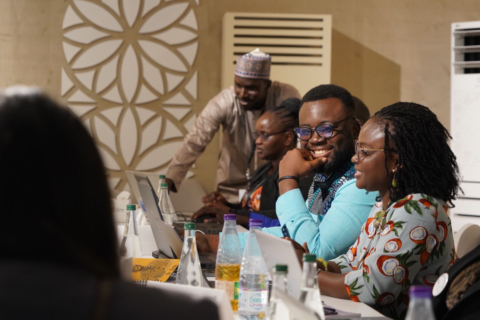
Pictured: A Geodata Workshop happening at the GEO-LDN Pavilion, conducted by Abubakar Isa-Abubakar.
What made the pavilion especially powerful was the opportunity for participants from 10 countries- Ghana, Kenya, the Democratic Republic of Congo (DRC), Benin, Senegal, Nigeria, Georgia, Mongolia, Peru, and Colombia—to present their real-world use cases. These countries showcased their efforts to apply Earth observation tools to report and monitor land degradation, helping to make progress toward LDN. The diverse range of participants enriched the conversations, sparking cross-border collaboration and a deeper understanding of the local challenges and solutions to land degradation.
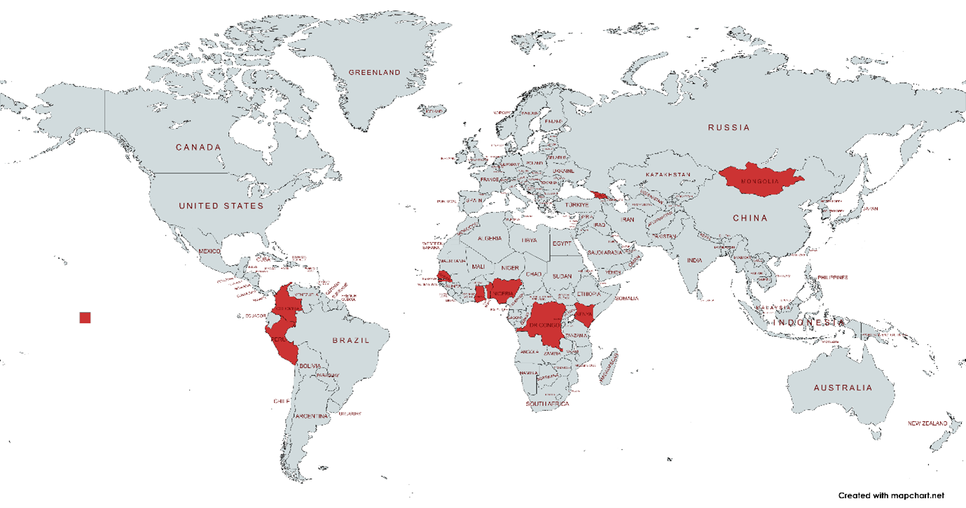 Pictured: A world map, all the countries that were represented at the GEO-LDN Pavilion marked in red.
Afterwards the participants answered a survey provided by GEO-LDN which showcased the intersectoral nature in which our work operates:
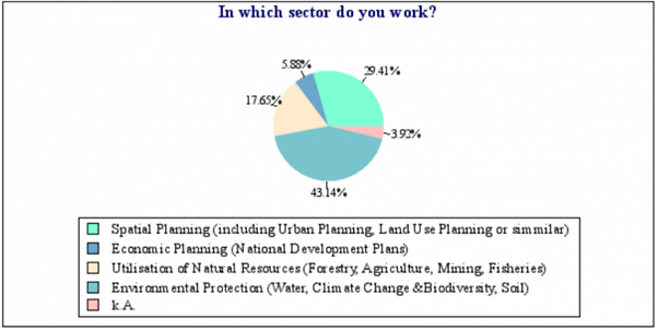
Pictured: The participants answer to a survey regarding their work sector. The strongest sectors represented were Environmental Protection, then Spatial Planning and Utilisation of Natural Resources.
Bringing together members from different sectors is key to achieving Integrated Land Use Planning whereby most stakeholders are presented and decisions on land are made with a participatory understanding.
One of the most exciting aspects of the pavilion was the chance for the country teams to network and exchange experiences, ideas, and best practices. The storytelling workshop, held on Saturday, 7th of December, was a particularly engaging part of this exchange. Participants learned how to share engaging stories about the impact of land degradation in their countries, helping to humanize the issue and bring forward creative solutions for land restoration. Storytelling is also integral to showcasing the importance of these technical fields to different members of society and governments.
Collaborating for Data-Driven Solutions
Furthermore, the GEO-LDN team led small group sessions on the use of high-resolution geospatial data for monitoring and restoring degraded land. About 20 Experts highlighted, in English, French and Spanish, platforms and tools that can help the country teams assess land degradation and track progress on restoration efforts. Sessions focused on the use of Digital Earth Africa, the KoBo Toolbox, GEE and other data-driven tools that are essential for achieving LDN goals. The trainings on Trends.Earth and the GEE Apps were received as particularly useful by the participants.
The discussions surrounding the use of data were lively, with participants sharing their experiences and challenges in applying these tools to real-world situations including the lack of national datasets, tools and datasets that are not interoperable and the failure of satellite imagery to capture certain contextual realities. This exchange highlighted how countries can learn from one another and adapt successful strategies to their own unique use cases.
Building on the Success of COP16
The energy and enthusiasm at COP16 demonstrated how crucial it is to keep building networks of collaboration and knowledge sharing. The GEO-LDN Pavilion was not only a place for learning but also a space where participants could forge partnerships and commit to long-term projects that will help restore degraded land across the world.
One participant from Ghana expressed their gratitude for the experience afterwards:
“It was a privilege to witness and be part of such an impactful gathering. I was particularly impressed and appreciative of the thoughtful approach taken to ensure inclusivity by offering sessions in both French and English for the participants of the GEO-LDN for the Digital Earth Africa training. This effort undoubtedly enhanced engagement and accessibility for a diverse group of participants, fostering a richer and more inclusive dialogue.”
This feedback speaks volumes about the success of the event, highlighting how it brought people together, encouraged open dialogue, and built stronger networks for future collaboration.
Key Announcements and Initiatives
Highlights of the conference included the Science, Technology, and Innovation (STI) High-Level Interactive Dialogue, during which, GEO-LDN co-chair Antje Hecheltjen, from GIZ, announced the launch of a Regional Dialogue Forum (RDF) in 2025 for Pacific Small Island Developing States (PSIDS). This forum, co-organized by the United Nations University (UNU-EHS), will focus on using geospatial data to address challenges in land degradation, biodiversity, and climate change in the Pacific region. The forum will also tackle data gaps that have made it difficult for these vulnerable regions to achieve LDN.
As Antje Hecheltjen, GEO-LDN Co-Chair and Head of GEO-LDN Secretariat, said during the announcement:
“GEO-LDN will work together with United Nations University to launch a Regional Dialogue Forum with the Pacific Small Island Developing States (PSIDS) in 2025. This forum will address Geospatial Data for LDN, Biodiversity and Climate Change and it will tackle the challenging data gaps for the SIDS."
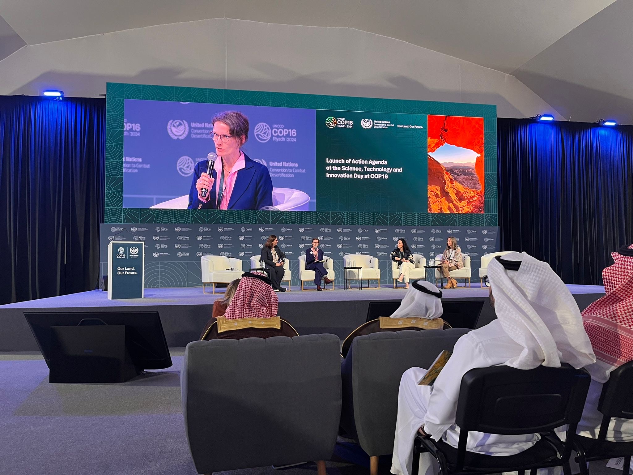
Pictured: Antje Hecheltjen at the Science, Technology, and Innovation (STI) High-Level Interactive Dialogue.
This initiative marks an important step toward bridging data gaps and ensuring that also the most vulnerable regions can work towards sustainable land use and restoration.
Another highlight from the High-Level Interactive Dialogue was the announcement of the Kingdom of Saudi-Arabia to become the newest GEO member states, after a yearlong negotiation by the GEO-Secretariat. This milestone marks a significant step in leveraging geospatial data to address the challenges faced by hyperarid regions. The decision follows extensive efforts by GEO to foster collaboration and bring new perspectives to these critical issues.
UNCCD Decisions
And last, but certainly not least:
The draft UNCCD decision ICCD/CRIC(22)/L.1 acknowledges the vital role of the Global Environment Facility (GEF) in advancing the GEO-LDN Flagship initiative. The GEF’s support has been instrumental in helping countries strengthen national reporting, utilize geospatial data, and monitor land restoration activities. Furthermore, the draft decision encourages the GEF to explore additional opportunities to support GEO-LDN, ensuring its continued success in addressing land degradation worldwide.
GEO-LDN’s Role in Building Global Collaboration
GEO-LDN aims to create lasting relationships between countries, scientific communities, and other stakeholders. By supporting data-driven solutions and promoting capacity-building, GEO-LDN is playing a key role in helping countries work together to achieve their LDN targets and helping countries achieve SDG 15.3.1 using geospatial data.
The events at COP16 Riyadh showed the power of collaboration and shared learning in tackling land degradation. With Saudi Arabia joining GEO and future initiatives like the SIDS Forum on the horizon, the GEO-LDN network is building strong partnerships to restore and sustain our land for generations to come.
Copyright: Pictures by Mark Grasy, Map by mapchart.de, Survey by Bernd Eversman